I started my hike in an attempt to hike the entire PCT. Being the anal person that I am, I meant to do it all,
without skipping a single step. Yes, I am one of those stupid purists who gets a ride into town from one side of the
highway, then gets back to that same side on the next day, to hike on from the exact same spot.
However, after a while I gave up. I wasn't enjoying the trail that much, and I had thoughts about quitting. When the
opportunity arrived, I decided I don't care that much for the trail anymore, and I should just do whatever I want
to, instead of forcing myself into following stupid rules, for no logical reason at all. So I started skipping.
I wasn't skipping whole giant sections, hitch hiking up and down the trail. Not that there's anything wrong about
it. But I occasionally let myself off easily. I admit.
After the Sierras, when I decided (again) that I want to keep on, and hike the entire trail, I decided I'd try to go
"pure" again. I knew it doesn't matter. It never did, actually. All that matters is whatever I felt matters. Being
pure now won't change me being not-pure before, nor should it. I just decided again I wanted to try it.
I started making lists in my head, about all the different miles I had skipped. I figured maybe somehow I'll do them
again someday. I don't expect I will, now. But I wanted to write down all the trail miles I haven't walked, with the
reasons/excuses I gave myself every time. Some are better than others.
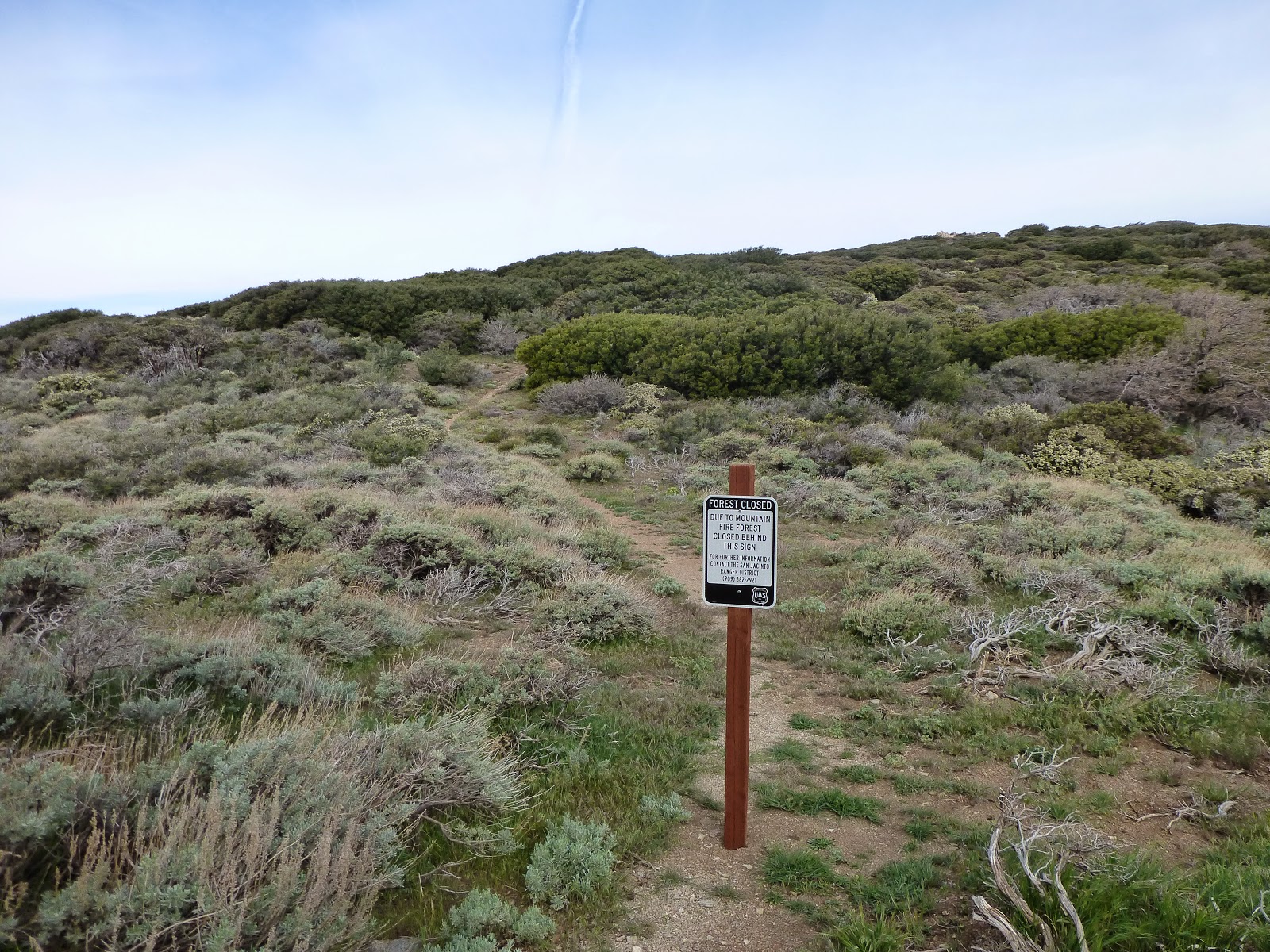
|
| I got up all the way to the closure |
162.64-178.00
(Cedar Spring Trail to Tahquitz Peak Trail)
- The famous ;
Mountain
Fire Closure. The trail is closed between those two locations, though most hikers get off the trail at
Highway 74 (mile 151.86), and either hitch into Idyllwild, or road walk all the way there on the highway. From there
most climb up to San Jacinto on the Devils Slide Trail on mile 179.40. I hiked on north from Highway 74 with the
intention of getting down the side south-western side of the mountain at the Cedar Springs Trail junction, and then
road walk on the highway up to Idyllwild, and climb through Tahquitz Peak back to the PCT. My plans got foiled when
I twisted my ankle right before I got to the highway, and I hitched into town, rested there for two days, rested two
more days at the ADZPCTKO, and then got a ride back to Idyllwild and limped up to Tahquitz Peak. I entertained a
thought of getting back to the road walk, on my way back from the Kick Off, but at the end I decided I would skip
that boring and dangerous section.
252.06-266.04
(Onyx Summit to Highway 18)
- I took a zero day at Ziggy and The Bear, feeling really light headed and not up to hiking, and Idan went on
without me. We were supposed to meet again in Big Bear, in 4 days. After hiking two days alone, and feeling really
depressed and done with the trail, I suddenly came upon Onyx Summit. I was surprised to see a road leading to Big
Bear, and even though I planned on hiking ~6 more miles, and then reaching town on the next day, I changed my plans
and headed into town from there. I had cell service, and talking to Idan I realized he was already zeroing in town,
and would leave tomorrow. So if I'd take another day, I'll have to keep on hiking alone. I spent a boring and lonely
evening in Big Bear Lake, and met up with Idan and headed out from the next road crossing on the next morning.
386.25-398.19
(Islip Saddle to Highway 2, 6th crossing)
- This one was around the
Endangered Species Closure. The official trail is closed from mile 390.30 (Eagles Roost)
to mile 394.30 (Burkhart Trail), but the official detour starts here, at 386.32, and goes around for 20.22 miles
(instead of 8 miles on the trail), all the way to Burkhart Trail. There is also an old alternate, that loops right
around the actual closer, and is only 5.44 miles.
When we got to the road crossing right before the official detour, we were planning on hitching back into Wrightwood
(After spending the previous night there), and have already called a local trail angel that will let us crash at his
place for the night. Our plans weren't met with success, as we were trying to hitch on that deserted road for ever,
and nobody stopped for us. Finally, as the sun went down, we made camp at the rest area over there, and
crashed.
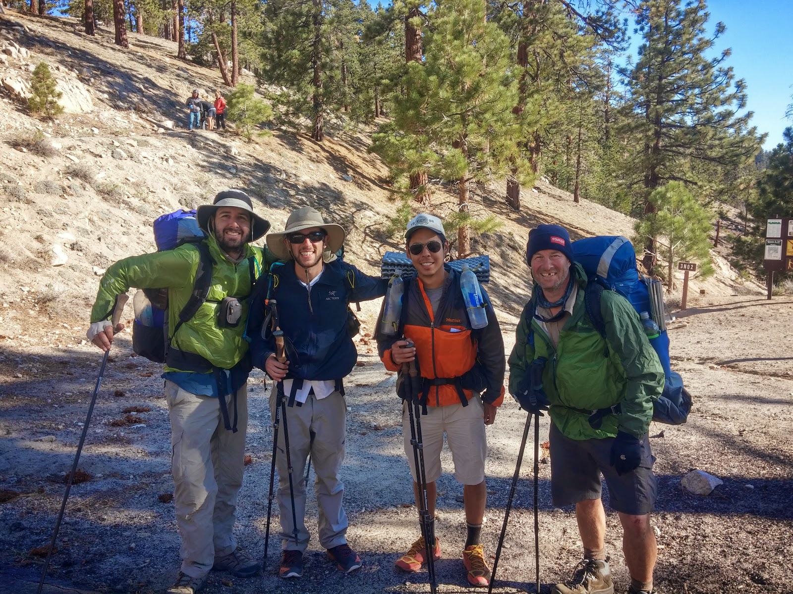
|
| 4 happy hikers, after cheating the trail a bit |
The next morning, we wanted to at least get a ride to the end of the closure (thus skipping both the official, 1 day
extra, alternate, and the old alternate). We didn't have any hitching luck in the morning as well, until we saw Kyle
and Snail Trainer coming down to the road. They spent the previous night at Little Jimmy Campground, and met a
weekend hiker named Barbara, who agreed on taking them around the closure. We joined in on the ride happily. Very
quickly we got convinced to hitching all the way to the next road crossing at 398.19, instead of getting of at
Buckhorn Exit, and hiking an additional 2.16 miles just to get back on the trail. As a consequence, when we finally
crossed the 400 miles marker, I didn't feel like it was much of an accomplishment.
454.50-456.65
(Exit for Hiker Heaven to Unpaved Road)
- After spending a nice zero day at
Hiker Heaven, we took
our time on heading out of there. I think we left a bit later in the morning, but still before noon. Donna arranged
for a ride to the trail, just to save us the short walk down the hill. But again - we were quickly persuaded to ride
all the way down to where the trail finally leaves the paved roads around Agua Dulce. This was a bit pointless, but
I don't think we missed any special sights on that road walk, and I was already in a "whatever" kind mood about
being a purist or even completing the trail. So - "whatever".
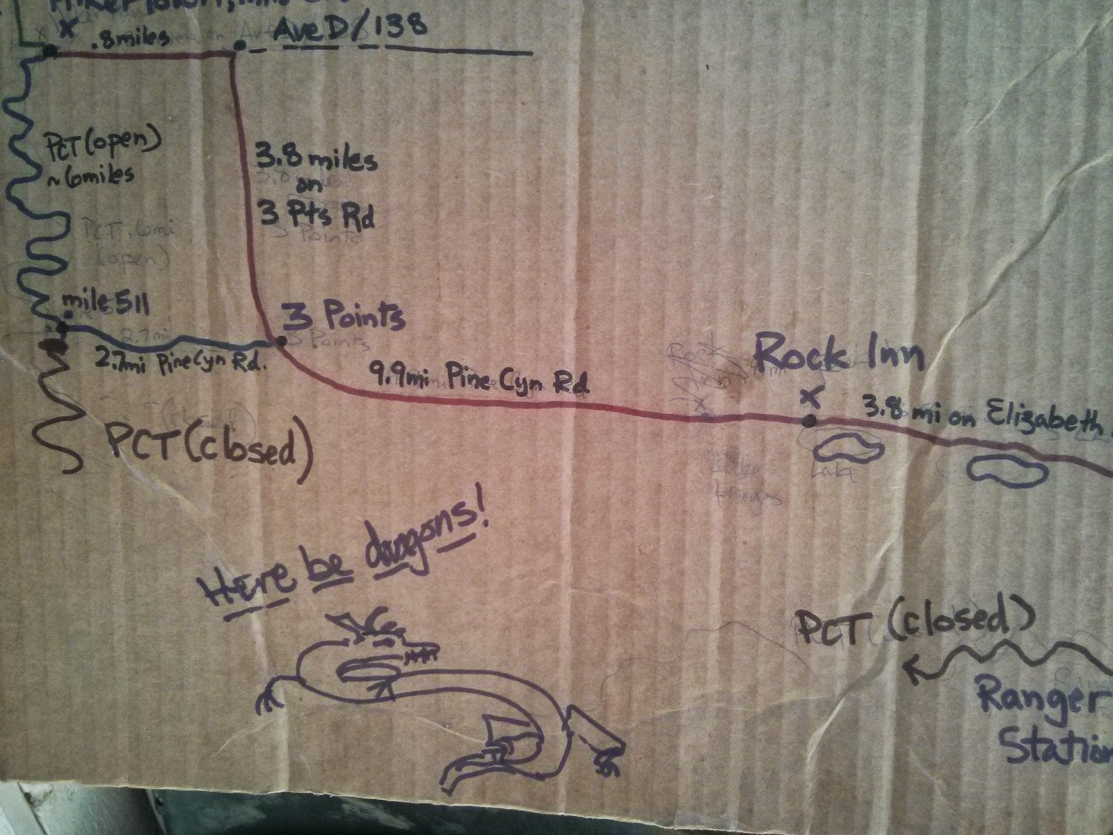
|
| A schematic map of the Powerhouse Fire Detour |
478.23-517.59
(San Francisquito Canyon Road to Highway 138)
- This not-so-little skip was around the
Powerhouse
Fire Closure, which starts at mile 487.23 and ends at mile 517.59 (Or maybe at mile 510.95 on Pine Canyon
Road - some people who did the road walk got back on trail over here). Walking the road around the closure is a
long, 20.3 mile, walk (or a 19.2 mile walk to Pine Canyon Road, and another 6.64 back on the PCT, up to Highway
138). So we just skipped it.
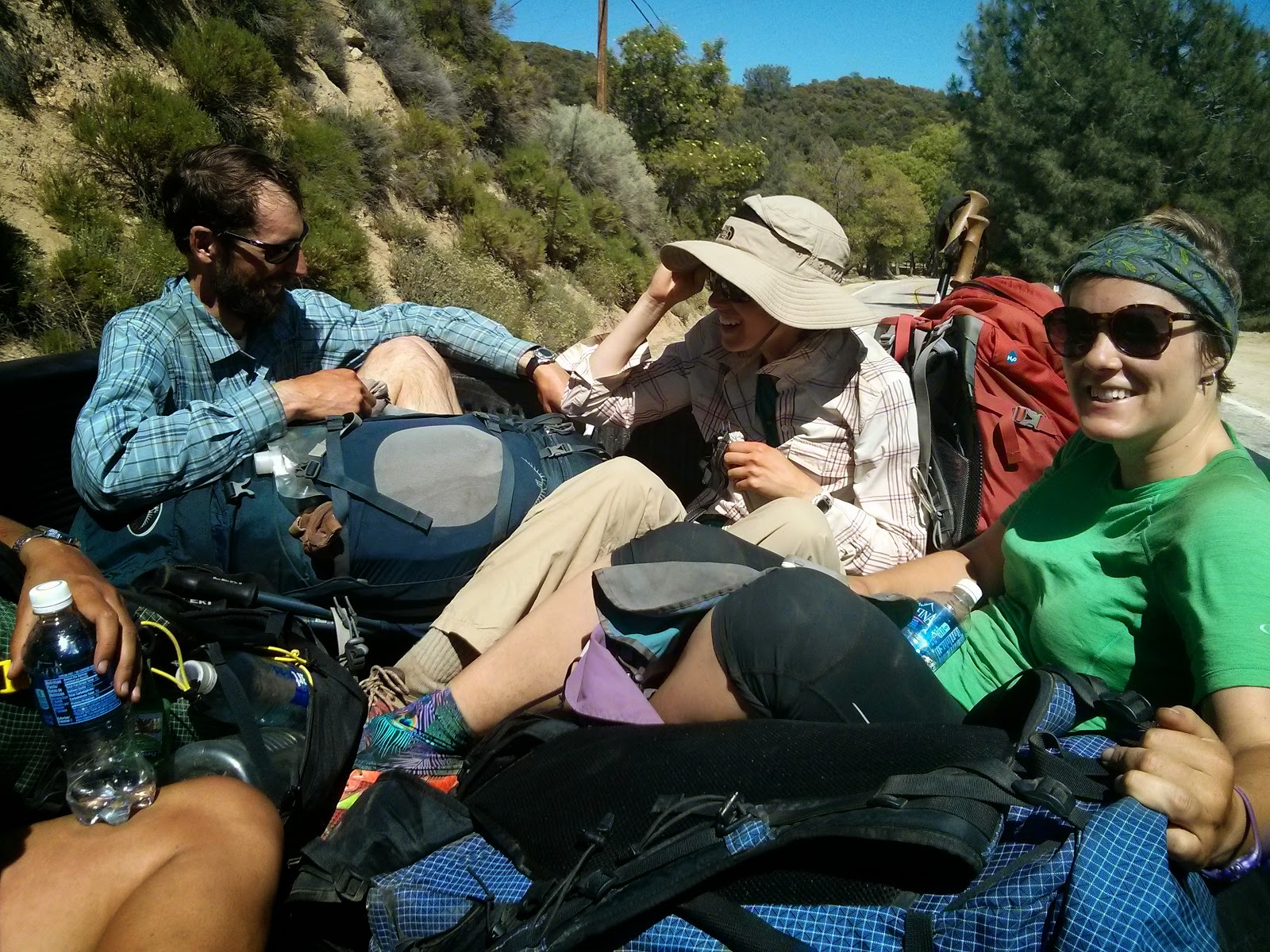
|
| Hitching a ride into Hiker Town |
558.51-566.44
(Tehachapi Willow Springs Road to Highway 58)
- This one was one of the most pointless skips I've made. No special reason to do it, other than how easy and
inviting it was. We went into Tehachapi on the first road crossing (Willow Springs Road), zeroed there for a day,
and headed out to the second road crossing (Highway 58). Thus - saving us about 8 miles of trail I'll never get to
see again... Stupid of me.
766.33-767.00 (Whitney Spur Trail to John Muir Trail)
- This is a short little bit we skipped, because we left the PCT and headed up towards Whitney on one trail,
and then later got back to the PCT while hiking the the JMT from Whitney, which was a tiny bit further north on
trail. I don't really consider this to be much of a skip.
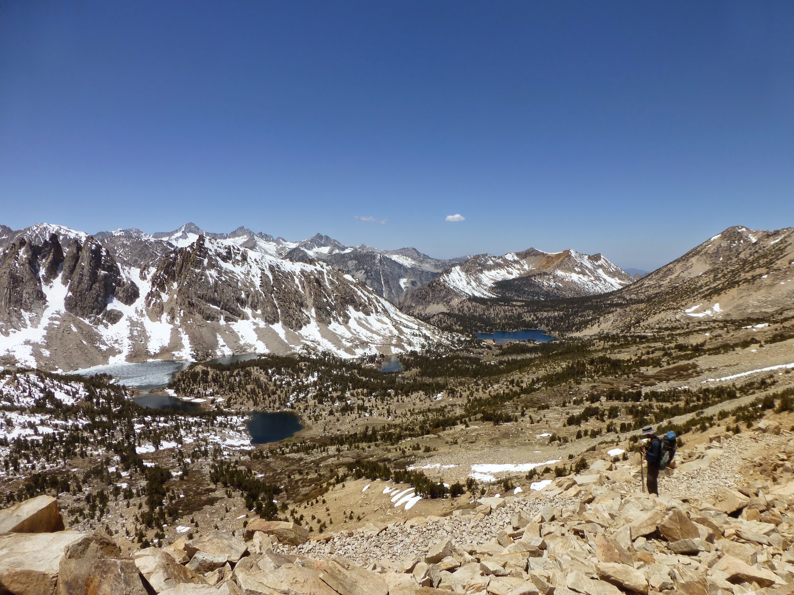
|
| View back towards Bullfrog Lake, from Kearsarge Pass |
788.47-789.08
(Bullfrog Lake Trail to Onion Valley Trail)
- Another tiny bit. We hiked out towards Kearsarge Pass and into Lone Pine on one trail and got back on another one,
thus skipping another 0.5 of PCT.
|
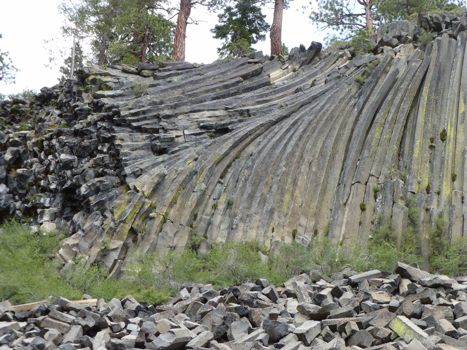
| The Devil's Postpile |
907.24-909.02 (Devils
Postpile Alternate)
- After leaving Mammoth Lakes through Red's Meadows, the trail goes by the famous Devil's Postpile. It's the
same distance on the PCT and on the alternate, and I figured I might as well see it, since I'm that close. So we
took it. It was nice enough.
909.02-922.92 (JMT
Alternate)
- Right after getting back to the PCT from the Devil's Postpile alternate, the PCT and JMT split for a short
section. Here, also, both alternates are almost the same distance, but the JMT section is supposed to have some
nicer hikes around lakes, and is generally considered more beautiful. I wouldn't know - I just hiked the JMT. It
was a nice enough section, and we had a lovely day.
940.84-942.50
(Tuolumne Campground Trail to Highway 120)
- Since we were planning on heading down to Yosemite Valley, to finish up the JMT with Yair, we cut over to the
Tuolumne Meadows campground when we reached the intersection. Two days later, when we took the bus up from the
valley, and back to the store, we kept on hiking from the highway.
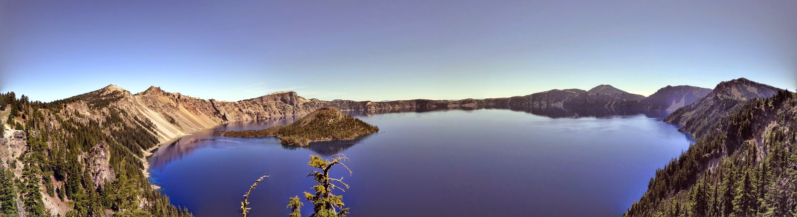
|
| I think it was worth the detour... |
1831.54-1843.62
(Crater Lake Alternate)
- I don't think there is any PCT hiker who doesn't hike along the Crater Lake Rim Trail. So I don't really need
an excuse here. It's the de-facto PCT. So much so, that the mileage marks on this detour, and further up the
trail, take into consideration hiking on the Rim Trail, and not hiking on the official, equestrian trail.
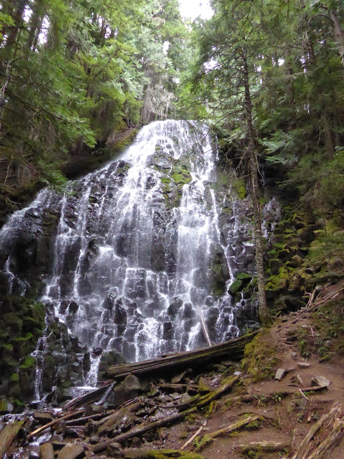
|
| This wasn't that impressive, in my opinion. I kinda reminded me of Amicalola
Falls, near the start of the AT.
|
2117.22-2119.33
(Ramona Falls Alternate)
- Another tiny alternate, that goes by Ramona Falls. The distance is identical to the official PCT, and I think
the trail was changed here to bypass the falls, mostly because of equestrian hikers. I figured that since I'm
going to hike the Eagle Creek Alternate on the following day, I can be just as "unpure" on this day, and see
some more nice falls. I wasn't too impressed with the falls, at the end.
|
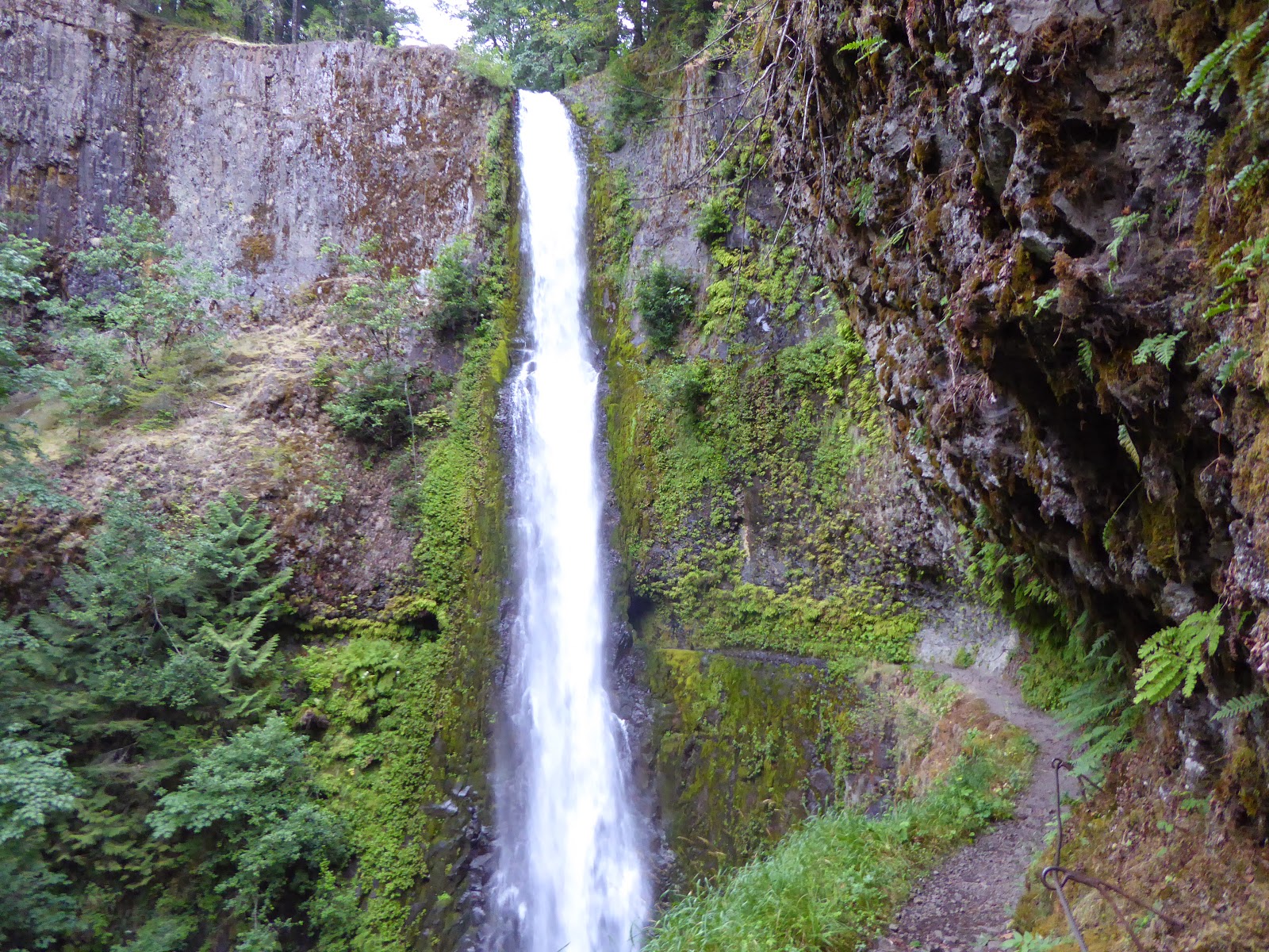
| And the famous Tunnel Falls |
2138.06-2154.70 (Eagle
Creek Alternate)
- Another de-facto PCT. Going down towards Cascade Locks (And the Oregon/Washington border) on the Eagle Creek
Alternate is what "everybody" does. The giant waterfalls are very special, and give a nice touch to the trail,
before entering the final state. Don't miss it.
In total, I didn't hike over 144.03 miles of the trail, which is %5.41. If I only include sections I hitched
around (as opposed to hiking on alternates), I skipped 90.72 miles (%3.41). Maybe I'll come and stitch it all
up, some day...


No comments :
Post a Comment